Posted on Leave a comment

Marco Polo Tracking Tag Comparisons

Newest generation of Marco Polo Tag Types (clockwise from top left): Advanced Pet Tag, Ultralight Tag, Advanced Drone Tag (note mounting tabs on side of case)Compatibility
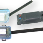
We get a lot of questions about the compatibility of the various Marco Polo tracking tags and handheld locators we’ve produced over the years. Here’s a few examples of the questions we get:

  • “I have an older tag and handheld locator I bought several years ago. If I buy one of the new tags for my system will they work together?”
  • “I recently bought a tag for my drone. Now I am thinking about getting one for my dog, do they work with the same handheld locator?”
  • “Will both the ultralight and the advanced tags work with the system I got for my drone?”

In all cases, the answer is YES! There have been a total of 5 versions of Marco Polo Tracking Tags made over the years, with 3 types in current production today. All of them work with every Marco Polo Handheld Locator ever made. If it says “Marco Polo” on it, it is going to work.

We have continued to make improvements in the tracking tags that work with your Marco Polo locator to allow a greater range of applications and increased durability. Here’s a rundown on the newest generation of Marco Polo tracking tags:

  • The Ultralight Drone Recovery Tag provides 30% greater battery life than the original design. It is easier to mount to your drone because it has a flatter bottom and all the controls on top for easier access when mounted. All in the same 12 gram package to allow for use on smaller drones.
  • The Advanced Drone Recovery Tag puts the same capabilities of the Ultralight tag into a waterproof (IP67 submersible), crushproof, polycarbonate enclosure. The new style tag can attach to a drone, rocket or fixed-wing aircraft in a variety of ways, including a clip-in mount, which makes moving the tag between aircraft a quick and simple operation.
  • The Advanced Pet Monitoring and Tracking Tag replaces the original “Classic” pet tag with a unit that is half the size and weight of the older generation. It is attaches tightly to the pet’s collar, giving a much better fit for smaller pets and because it is less obtrusive when mounted on the collar it helps avoid snags that might harm your pet or damage the tag. The Advanced tag is waterproof for prolonged swimming.

The photo below shows the newest generation of Marco Polo Tracking Tags currently being sold.


Newest generation of Marco Polo Tag Types (clockwise from top left): Advanced Pet Tag, Ultralight Tag, Advanced Drone Tag (note mounting tabs on side of case)
Newest generation of Marco Polo Tag Types (clockwise from top left): Advanced Pet Tag, Ultralight Tag, Advanced Drone Tag (note mounting tabs on side of case). These tags will work with ALL handheld locators we have ever produced.

The following photo shows the earlier generation of Marco Polo Tracking Tags. These tags are no longer available.

Older generation of Marco Polo Tag Types: (L) "Classic" Pet Tag, (R) Ultralight Tag. These are no longer available.
Older generation of Marco Polo Tag Types: (L) “Classic” Pet Tag, (R) Ultralight Tag. These tags are no longer available.
Posted on

Finding A Drone In A Tree Using Azimuth Readings

Deep Forest With Lost DroneGreat Tip!If you have tested the tracking function of your Marco Polo Drone Recovery System, or used it to recover a lost drone, rocket or RC Airplane, then you know what an invaluable tool it can be. Something that you may not be aware of is the ability to locate a tracking tag that is lodged in a tree!

Imagine you crashed your drone (ok, nobody actually crashes so let’s call it an “unintentional landing”) in a forested area. You’ve used the Marco Polo system to track your drone into the forest. You may eventually come to a place where you have a very high signal level on the locator but you are receiving either no bearing indications or confusing readings. You know your drone is close by, but where is it? It’s possible your aircraft is above you in the tree canopy but impossible to see.

So now what? Simple, you do is something we warn you NEVER to do during a normal ground search – hold the locator pointing straight up as though you were looking into a hand mirror. Now, instead of measuring azimuth about the horizon, it is measuring the elevation angle in the plane of the LCD display. To find the point that is directly under the tracking tag, pick a direction to face, let’s say North. Now, step sideways with the bottom of the locator facing north and the plane of the LCD being East and West. Move sideways, East or West until the directional arrow points straight up. Now, turn to face 90 degrees to the original direction, let’s say West. Now move sideways North and South until the arrow points straight up again. You might turn North again to see if you need to correct your position. When you get to the point where the arrow points straight up when facing North and West, then you are directly under the tag.

This sounds a lot more complicated than it really is. We recommend you practice this technique a few times to become familiar with the steps outlined above, especially if you plan on flying around trees or other objects where your drone could “unintentionally land”  high off the ground.

Testing Marco Polo to Determine Azimuth
Here’s how we tested the setup: (1) Attached a Marco Polo tag to some helium filled balloons; (2) Sent the tag aloft with a few hundred feed of monofilament line attached to a fishing rod.


Using Marco Polo To Get An Elevation Display
Imagine your drone is stuck in a tree, but which one? This is how you would find it. (1) With the tag aloft, the Marco Polo locator is held as shown. The arrow will then point vertically in the direction of the tag; (2) You move around to get multiple readings to “triangulate” the azimuth readings and zero in on the tree where the drone is.

There may be other times when an elevation reading is useful. In the attached photo a Marco Polo tag was suspended from helium balloons and the elevation tracked. Imagine that this was a descending rocket, or a drone that crashed on the side of a cliff and you would like to know if it is near the top or bottom of the cliff. You will find your own uses now that you have started to think of the directional display in 3 dimensions!